Full Moon Hike
Join us on Thursday January 25th for a full moon hike at the Deborah and Roger Richardson Nature Preserve. Beginning at 8 pm, ALT board members will lead a moonlit walk through the preserve. Dress warmly, including shoes that are waterproof, and bring a flashlight or headlamp. Walk is a little less than a mile! Short and sweet, but a great opportunity to see the full moon and its beauty!
Meet at parking lot at 577B Wilmarth Street.
Any cancellations due to weather conditions or overcast skies will be posted on our Facebook page.
Dogs not permitted at this event.
MLK Day Event to be co-sponsored by ALT
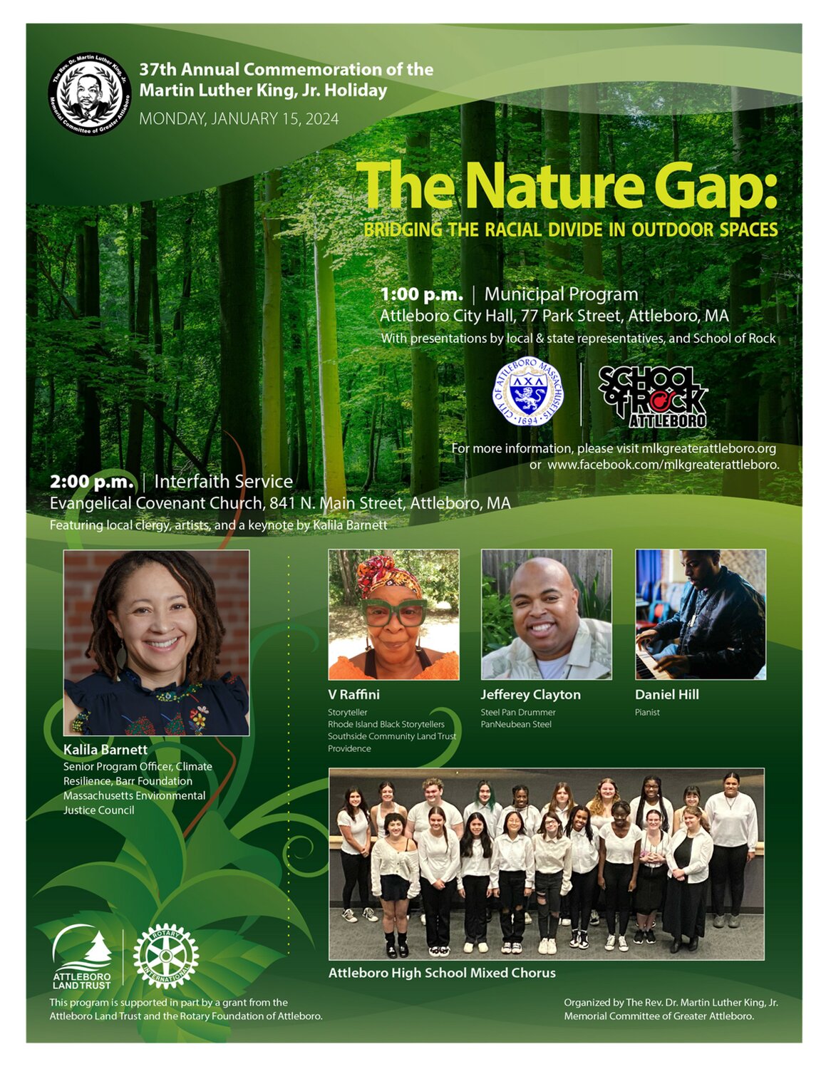
Please join us on Monday, January 15, 2024, as the MLK Committee of Greater Attleboro hosts its 37th annual commemoration of The Rev. Dr. Martin Luther King, Jr. holiday. The program theme: environmental equity, will address racism in outdoor spaces and other environmental issues impacting African Americans and historically marginalized groups.
The day’s events will feature a municipal program with local and state representatives at 1:00 p.m. at Attleboro City Hall, followed by an interfaith service at 2:00 p.m. at the Evangelical Covenant Church, 841 North Main St, Attleboro.
At the interfaith service, Kalila Barnett will deliver a keynote address on the committee’s theme: “The Nature Gap: Bridging the Racial Divide in Outdoor Spaces.” Ms. Barnett is the senior program officer of Climate Resilience at the Barr Foundation and serves on the Massachusetts Environmental Justice Council. The service will also feature a performance by storyteller V Raffini, selected readings from local clergy, and music by steel pan drummer Jefferey Clayton and the Attleboro High School Mixed Chorus.
The Attleboro Land Trust board voted in October to co-sponsor the keynote presentation and will be at the church to greet community members following the service. We hope you’ll attend and join us in celebrating Dr. King’s 95th Birthday!
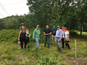
Volunteers got it done in 2023!
At the Annual Meeting on November 16, Property Management Committee Chair Charlie Adler asked everyone present who had helped in the maintenance of our properties over the past year to stand, and he thanked them for the essential work that they voluntarily do for the good of the land trust. He was especially appreciative for the number of people who volunteered to be site stewards this year.
He also singled out the following individuals for noteworthy accomplishments:
- Bill Ward – mowing the hayfields at Richardson.
- The Mowing Team for mowing the lawn areas at Richardson – Phil Boucher, Randy Lithway, Russ Pray. Also pitching in were James Tetreault and Johnny Bender.
- Russ Pray – rebuilding the bulkhead of the Barrows House at Richardson.
- Macie Broussard – monitoring the bluebird houses at Richardson.
- Lauretta Koch – for tending the perennial gardens at Richardson.
- Dave Rolince and Scott Hirshberg for some major repairs to the Scout boardwalk at Colman.
- Mike Davis and his sidekick Alan Henry for being our Storm Response Team and doing whatever is necessary to mitigate the effects of fallen trees at our properties.
- Randy Lithway for suggesting and completing a new pathway across from the Colman parking lot to the beginning of the Vaughan trail.
- And last but not least, board member and attorney Patrick Sullivan for his assistance in matters where our boundaries must be defended from encroachment.
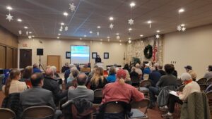
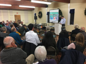
ALT Members Celebrate Achievements at Annual Meeting
On November 16, 2023, we held our Annual Meeting. The event was a great success, with a fantastic turnout and a lot of positive feedback from attendees. The event featured a keynote speaker, updates on land acquisition, financials, and election of directors new to the board or continuing for another three-year term.
The event started with a warm welcome from our president Jay Burby. Our keynote speaker, Eva Vaughan, an environmental analyst for the Massachusetts Executive Office of Energy and Environmental Affairs, then took the stage and delivered an engaging talk on backyard green infrastructure. Eva explained how simple landscaping modifications can turn a backyard or home garden into a rain garden, thus helping to control and purify stormwater runoff. A few native plantings can then attract pollinating insects, helping to preserve biodiversity.
After Eva’s talk, ALT President Jay Burby reviewed highlights from 2023, including the most recent donation of land from the Charron family, that put us above 500 acres owned by the ALT with an additional 236 acres protected for a total of 740 acres. The 12-acre Charron Farm Preserve will continue to be used for the production of hay, but will also be used to complete a trail that will connect to the adjacent Shaw-Denham Memorial Forest. The trail will open to the public once completed.

Ted Leach nominates new and returning board members while President Jay Burby looks on. Image credit: Erin Connell
Veteran board member Ted Leach nominated members Brian Hatch, Roy Belcher, Paula Murphy, and Dawn Bender, whose terms expire in 2023, to serve for another 3-year term. Tarah Kinniburgh was nominated to her first term. Members present voted unanimously to elect all the nominees.
Juliet Teixeira, who is stepping down as ALT Vice President and Community Garden Lead, was thanked for her service and dedication to the work of the land trust, and the community garden, over the past ten years.
The ALT hopes to give renewed emphasis to education and outreach in 2024. Erin Connell, who joined the board last year, has agreed to chair the Education and Outreach Committee. Membership in this committee is open to any ALT member. You don’t have to be on the board. The same is true for most of the ALT standing committees.
Overall, the ALT Annual Meeting was a great success, and we are grateful to everyone who attended and made it such a memorable event. Thank you for your continued support of the Attleboro Land Trust!
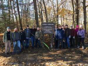
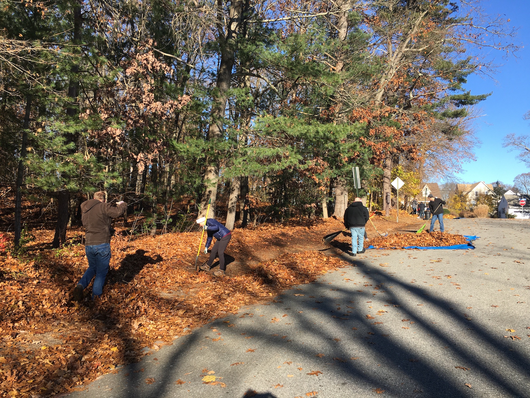
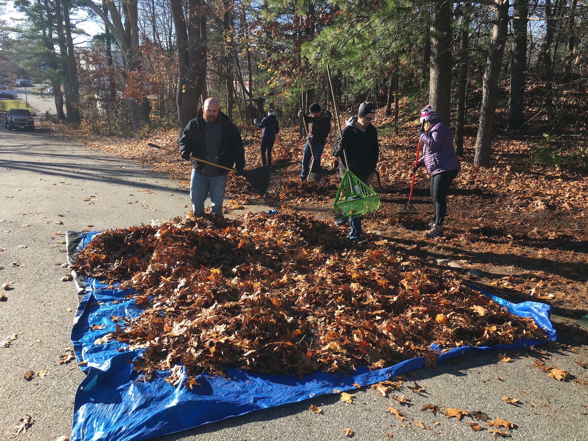
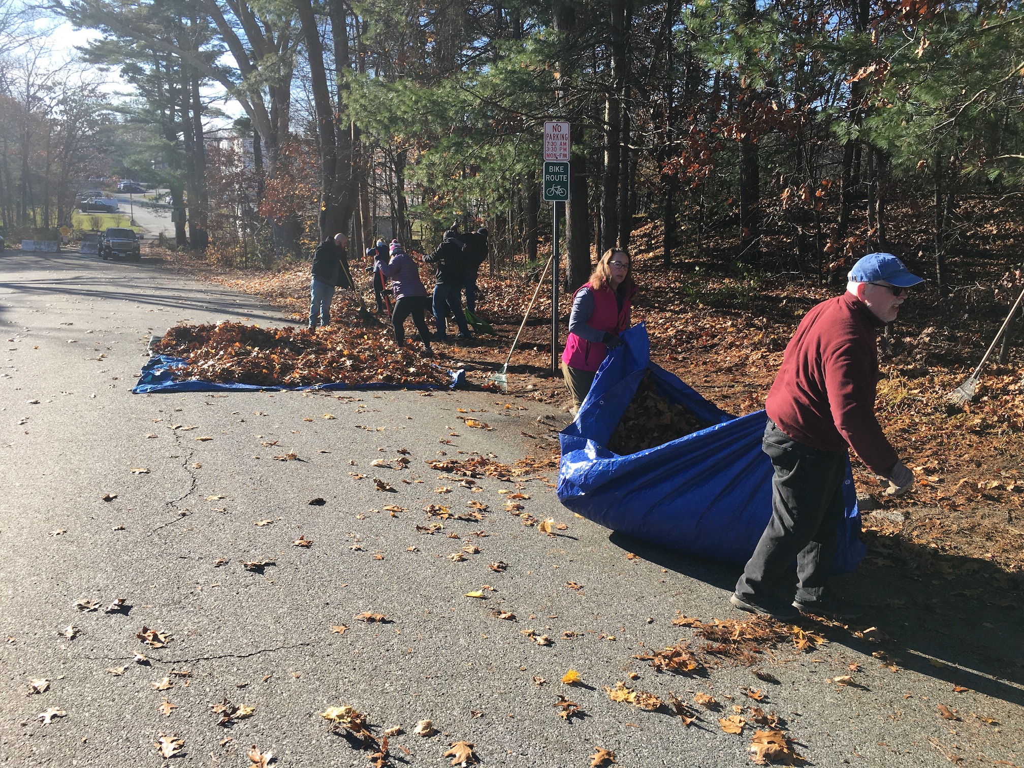
Many Hands Make Light Work at Fall Clean-Up
Every year the edges of Larson Woodland are piled high with the leaves dropped from the trees along Riverbank Road and Watson Avenue. It takes a lot of effort to rake them up and move them away from the old stone curb, so that pedestrians can walk along the edge of the woodland.
On Saturday, Nov. 25, we had an outstanding crew of site stewards and other volunteers helping with this effort, including seven members of the Ezekiel Bates Lodge of Attleboro. The Lodge has been partnering with the Attleboro Land Trust as a site steward of Larson Woodland since 2014.
Annual Meeting on November 16
The annual meeting of the Attleboro Land Trust will be on Thursday, November 16, at 6:30 pm. It will again be in-person at Murray Unitarian Universalist Church, 505 North Main Street, Attleboro.
The event will begin with the traditional social half-hour before the business meeting and keynote address. Eva Vaughan, an environmental analyst for the Massachusetts Executive Office of Energy and Environmental Affairs, will deliver the keynote–on Backyard Green Infrastructure. Eva will be discussing the impact of climate change on inland flooding and sharing ways we can adapt to combat the issue, even in our own backyards.
This meeting is open to the public, so please bring a friend. Only members of the Attleboro Land Trust can vote during the brief business meeting.
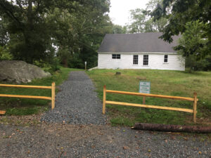
Volunteers invited to help with maintenance at Richardson Preserve on Oct. 28
Our next work party will be on Saturday, October 28, at the Deborah and Roger Richardson Nature Preserve, 577B Wilmarth Street, Attleboro, from 9:00 am to 12:00 noon. If you are available, we would welcome your help, whether you are a seasoned volunteer, or this is your first time volunteering for the Attleboro Land Trust.
Various “housekeeping” tasks will include:
–Cleaning mildew off the sides of the Barrows House
–Raking up the seed husks that have fallen from the Chinese chestnut tree
–Sweeping leaves off the boardwalks
–Cleaning out the leaf matter that has built up between the slats of the boardwalks
–Washing grime off the trailside signs
–Touching up areas with peeling paint on the Barrows House and some signs
We will have tools and supplies, but please feel free to bring anything you think might be helpful, including containers of water for some of the cleaning tasks, as the site has no running water.
Dress accordingly for protection against poison ivy and ticks. Please bring your own:
— Work gloves
— Water bottles
Volunteers under 18 must be accompanied by an adult.

Charron Farm Work Party Postponed to Oct. 1
Due to the rainy weather forecast, the work party at Charron Farm Preserve is postponed from Sept. 24 to Sunday, October 1, from 1:00 to 4:00 pm.
Volunteer help is needed to dig post holes for boundary markers and regulation signs. Also, trees and shrubs need to be trimmed along the edges of the hayfields.
Directions:
From downtown Attleboro, take County Street south for 3.8 miles.
Turn right onto Read Street and drive 1/2 mile.
Turn left onto Morse Avenue and drive 1/4 mile.
Stop next to the open field on your right, just after the recently-constructed home at 41 Morse Avenue.
Park on the edge of the road.
(Don’t rely on Google Maps, which mislabels part of Morse Ave. as Gillette Ave.)
Tools needed include:
— Loppers, pruning shears, pruning saws, and other pruning tools
— Pole saws
— String trimmers, weed whackers, brush cutters
— Tarps
— Chain saw
— Shovels
— Post hole diggers
We will have some tools, but please bring what you have. If anyone has a mechanical auger, please let us know in advance by contacting: attleborolandtrust@gmail.com
Dress accordingly for protection against poison ivy and ticks. Please bring your own:
— Work gloves
— Water
Volunteers under 18 must be accompanied by an adult.
Celebrate 25 Years of Community Gardening
Update: Due to flooding at the Garden earlier this week and impending inclement weather, the event will be held at the Attleboro Public Library.
Join us in celebrating the Attleboro Community Garden’s 25th anniversary on Saturday, September 16. The event is free and open to the public. It will run from 1:00 to 3:00 pm and will take place at the Attleboro Public Library, 74 North Main Street.The afternoon all-ages program will include:
- 1:15 “Save Seeds- Save for the Future and Save the Past” presentation by Master Gardener Kathi Gariepy.
- 2:00 “Preserving Your Harvest” presentation by Modern Homestead & Gardens founder Danielle Cournoyer.
- A garden-themed drop-in painting activity for children will run from 1:00 to 2:30.
- 2:40 A program celebrating the Garden’s achievements will take place.
Throughout the event:
- Gardening information table
- Raffles and light refreshments
For more information contact attleborocommunitygarden@gmail.com
When
September 16th at 1:00 to 3:00 pm
Where
The event will take place at the rain location at the Attleboro Public Library, 74 North Main Street.